Advent of Europeans in India
Vasco da Gama
Arabs and their plundering raids along the land route
Astrolabe for fixing the height of heavenly bodies for navigation and mariner’s compass
Gunpowder kept ships safe from attacks, adding more firepower, making them easier to carry and more stable, and helping to make the most destructive weapons of the time.
Venice and Genoa
Constantinople in 1453 and established the Ottoman Empire, stretching from Syria to Egypt.
Henry the Navigator, prince of Portugal, initiated the first great enterprise of the Age of Discovery
King Charles I of Spain funded the Magellan expedition with the hope that it would discover a profitable western route to the Spice Islands
In the late fifteenth century, Portuguese explorer reached the shores of the Indian subcontinent, establishing maritime connections that marked the onset of European influence. Subsequent expeditions by other European powers, including the Dutch, English, and French, intensified this engagement, leading to competition for trade dominance and territorial control.
The establishment of trading posts and colonies paved the way for a new chapter in India’s history, shaped by global interactions and the eventual ascendance of British colonial rule. The arrival of Europeans would indelibly shape India’s destiny and leave a lasting imprint on its social, economic, and political landscapes.
1. Reasons for Advent of Europeans in India
⇨ Unstable Land Route: In the Middle Ages (5th century CE to 15th century CE), traders preferred the land route from the Middle East to Europe. However, with the rise of in the tenth century made land route unstable and dangerous for trade.
⇨ Safe Passage through Water: While the land with some passes fell within the territory of one or the other kingdom, the oceans and seas had not yet been controlled and thus offered a safe passage.
⇨ Advancements in Navigation: The period witnessed several technological advancements. The advancements in navigation with the use of by the Arabs and shipbuilding by the Europeans at a time when land routes had become unstable made waterways a natural choice.
⇨ Advancement in Ship Defence System: Invention of in China in the ninth century, spread to Eurasia by the end of the thirteenth century. As sea voyages gained popularity in the fifteenth century, canons and gunpowder began to be used on ships to protect them from attacks.
⇨ Monopolies: The merchants of monopolised the trade between Asia and Europe. The western side, the Mediterranean area, was under the merchants of Venice and Genoa, and the eastern side, the Asian side, was under the Arab merchants. These merchants did not allow new merchants from other West European countries to trade through the old routes under their control.
⇨ Ottoman Empire: The Ottoman Turks captured This brought the old routes under Turkish control. Moreover, the expansion of Turkish power in Eastern Europe and the growth of the Turkish navy alarmed the Europeans.
⇨ Rise of New Nation States: The later part of the 15th century saw the rise of centralised states with strong kings, like that from Spain and Portugal , who were keen to trade with Asia. The Kings encouraged, often supported and sponsored geographical explorations and navigators.
⇨ Division of non-Christian world: The Treaty of Tordesillas(1494) divided the non-Christian world between Portugal and Spain, granting Portugal the eastern territories and Spain the western territories. This set the stage for Portuguese incursions into the waters around India.
⇨ Economic Growth in Europe: The European economy expanded rapidly due to the expansion of land under cultivation, the introduction of improved ploughs, and scientific crop rotation. As a result of this growth, towns rose, and trade increased.
⇨ Demand for Spices and Pepper: The economic revival in Europe increased the demand for spices and pepper needed to make meat palatable.
⇨ Tolls and Taxes: Tolls and taxes were constantly increased on the European and Asian trade sides, reducing profit margins.
⇨ Profit Maximization: Although trade between Asia and Europe was carried on along several routes, it was highly profitable. However, raids along the land route and monopolies by various groups had reduced profits. Thus, there was an attempt to maximise profit through new trade routes.
⇨ Renaissance: The cultural revival or Renaissance in Europe during the fourteenth century infused a spirit of daring and adventure among the people of Western Europe.
⇨ Glory: Above all, the desire to achieve glory acted as an inspiring factor for navigators and explorers.
⇨ Mercantilism: A set of economic doctrines and policies involving state intervention to promote national prosperity and strength, mercantilism gripped the European states in its clutches.
Proselytising Zeal: The explorers were motivated to spread Christianity into the new lands.
2. Portuguese in India
Early or Lower Paleolithic
The earliest use of stone was started in the Lower Palaeolithic Age by Homo habilis and Homo erectus. Lower Palaeolithic Age in India is between (5,00,000- 1,00,000 BC)
Middle Paleolithic
Middle Palaeolithic culture in India is called Nevasian (similar to Mousterian), as flake tools were found at Pravara, Nevasa. Middle Palaeolithic Age in India is between (1,00,000- 40,000 BC)
Late or Upper Palaeolithic
This is the phase when modern man (Homo sapiens sapiens) first emerged around 50,000 years ago. Upper Palaeolithic Age in India is between (40,000-10,000 BC)
While the General Economic Subsistence pattern was Hunter and Gatherer (These people hunted animals and gathered plants and fruits, that is why we call them hunter and gatherers) throughout the three phases of the Paleolithic age but he Hunting tools differed with from Lower to Upper Paleolithic. Due to the need to follow food sources, Paleolithic societies were nomadic, moving from place to place depending on seasonal availability of food.
Preoccupied Caves Shelters – They are big sandstone rock Shelters . Even temporary pits were used. People also took shelter in trees for protection from animals that couldn’t climb them.
People Lived in Communities and In order to ensure enough food production for their communities, they worked to manipulate those systems in certain ways, such as rotational hunting and gathering. Generally men Hunted for Food while women gathered their own food . Everyone was Equal
Based on the grave goods found beside the deceased, upper paleolithic burials are undoubtedly evidence of spirituality and religiousness
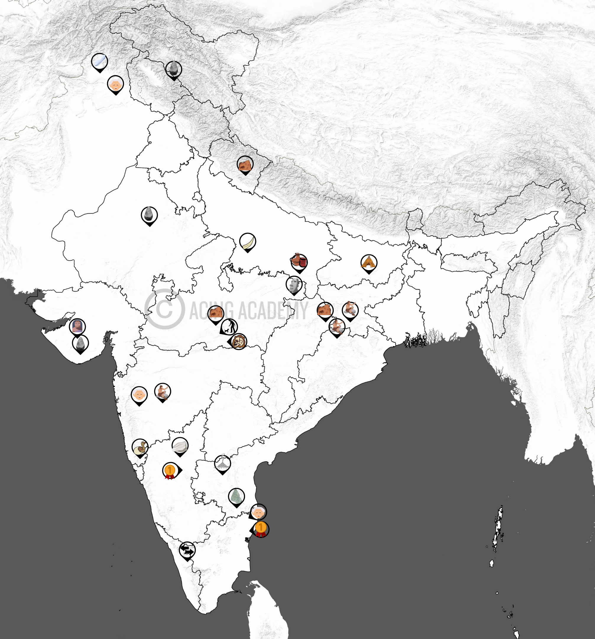
We did not get any evidence of paintings from lower or middle paleolithic age yet. In the Upper Palaeolithic period, we see a proliferation of artistic activities. First discovery of rock paintings in the world was made in India (1867-68) by an Archaeologist, Archibold Carlleyle, twelve years before the discovery of Altamira in Spain (site of oldest rock paintings in the world). In India, remnants of rock paintings have been found on the walls of caves situated in several districts of Madhya Pradesh, Uttar Pradesh, Andhra Pradesh, Telangana, Karnataka, Bihar, and Uttarakhand. Subjects of early works confined to three categories: Man, Animal, and Geometric symbols.
Pahalgam
Located In Anatnag district, J&K. Here A hand-axe
and flakes was discovered. Kashmir lacks Palaeolithic
tools in abundance becauseit was intensely cold
during the glacial times.
Riwat (Potwar Plateau)
Oldest dated Palaeolithic sites in South Asia (~2
million years ago). Core tools of Pre-Acheulian/Mode
variety found. Associated with Homo erectus.
Sanghao Caves
Middle and Upper palaeolithic occupation. Stone
tools along with bones and hearths. All the tools
are made of quartz.
Lakhudiyar
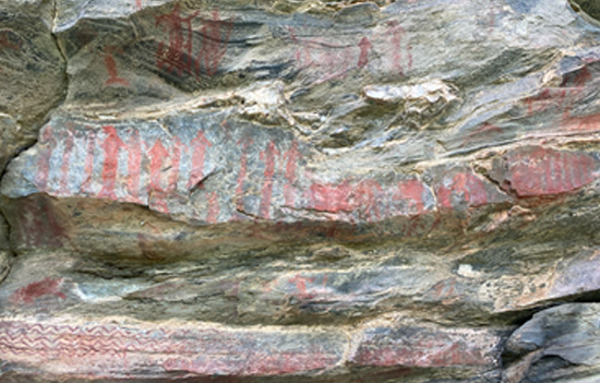
Lakhudiyar is a prehistoric rock shelter .It's known
for its rock paintings dating back to the Upper
Paleolithic period, showcasing depictions of
animals, humans, and geometric shapes,
created using fingers in black, red, and white
colors. site located in the Almora district of
Uttarakhand, India, along the banks of the
Suyal River.
Sohan Valley
The Sohan Culture is associated with the Lower
Paleolithic period and The valley is particularly known
for the discovery of Oldowan tools, like choppers and
flakes. It is Named after the Sohan River valley in
Pakistan.
Chopani Mando
It provides the earliest evidence of the use of pottery
in the world It is located on the left bank of the Belan
River, a tributary of the Ganga River.A habitation site
with cultural sequence from the upper Palaeolithic to
Neolithic age. Evidence of early domesticated animals
has been found too.
2. European Powers in India in Sequence
Important Portuguese Travellers/ Generals in India
1. Vasco De Gama
Vasco da Gama was a Portuguese explorer and nobleman who was the first European to reach India by sea. Initially, he was welcomed heartily by the Hindu population but later on, when he offered relatively cheap gifts upon his arrival to Zamorin, the king of Calicut, the tension between the two of them started. He Spent Three months on his First arrival. Upon his return to Portugal Da Gama was greeted as a hero and the monarch bestowed the title ‘Dom’ upon him. He returned in 1501. He was Appointed as Portuguese Viceroy to India in 1524
⇨ Discovered the European sea route to India
⇨ He established a trading factory at Cannanore which later became an important trading centres of the Portuguese.
2. Francis de Almeida
Dom Francisco de Almeida also known as the Great Dom Francisco (c. 1450 – 1 March 1510), was the first Portuguese governor and viceroy of India. He was a Portuguese nobleman, soldier, and explorer. He served from 1505 to 1509. He also Served as a counselor to King John II of Portugal . His primary goal was to destroy Muslim trade by capturing strategic ports like Aden and Ormuz.
⇨ Introduced the “Blue Water Policy” to control the Indian Ocean
⇨ Almeida built forts at Anjediva Island, Cannanore, Cochin, and Kilwa, helping expand Portuguese power in the region
⇨ Won the naval Battle of Diu against a joint fleet of the Sultan of Gujarat, the Mamlûk Burji Sultanate of Egypt and the Zamorin of Calicut easing Portuguese strategy of controlling the Indian Ocean
⇨ Concluded a commercial treaty with Malacca (now Melaka, Malaysia)
3. Alfonso de Albuquerque
Afonso de Albuquerque, 1st Duke of Goa, was a Portuguese general, admiral, and statesman. He served as viceroy of Portuguese India from 1509 to 1515,
⇨ Conquered Goa from the ruler of Bijapur in 1510, making it the Portuguese headquarters in India.
⇨ Albuquerque also captured Malacca and Ceylon and built a fort at Calicut.
⇨ First to abolish the practice of Sati, which was vogue in that time and also encouraged his countrymen to marry Indian women.
⇨ The Portuguese under Albuquerque introduced a permit system for other ships in the region.
⇨ At the time of his death in c.1515 CE, he left the Portuguese as the strongest naval power in India.
4. Nino Da Cunha
Nuno da Cunha (c. 1487 – 5 March 1539) was a Portuguese admiral who was governor of Portuguese possessions in India from 1529 to 1538.
⇨ Under the command of Governor Nuno da Cunha, the Portuguese had attempted to capture Diu by force in February 1531, unsuccessfully.
⇨ Also Signed the treaty of Bassein ( 1534) with Bahadur Shah giving Bassein and the seven islands of Bombay to Portuguese in exchange for Portuguese assistance against the Mughals
⇨ In 1535, the Portuguese were allowed to construct a fortress at Diu.
Decline of Portuguese Power in India
Impact of The Portuguese Rule on India
1.2 Wave Depositional Landforms
Introduction
The sandbar is the ridge of sand or coarse sediment that is built over a period of time by the waves
Formation
It is formed by the process of longshore drift, which is when sediment is moved along a shoreline due to the action of waves and currents. ➜ This creates a ridge or bar of sediment overtime
Introduction
Barrier bar which gets keyed up to one end of bay creating a hook is called spit. This Hook is generally toward the quieter waters close to shore.
Formation
These are formed just in the same way a Sand Bar forms. A hooked end can form if the wind direction changes.
Introduction
When a long, narrow ridge of sand Island, runs parallel to the shore often separating a shallow lagoon or bay from the open ocean , it is called a “barrier Island”
Formation
Barrier islands can grow from spits and Bars that are broken up. These bars and Spits grow up above the water line over time forming these Island Features.
Introduction
When the mainland is attached to an island by a narrow piece of land such as a bar or a Spit it is a Tombolo
Formation
Similar to sand Bars and spits, Longshore drift moves sand out along the coast➜ As sediment accumulates and is deposited between the island and the mainland, a ridge or bar of sediment begins to form. ➜ Over time, the build-up of sediment increases, connecting the island to the mainland
Introduction
A lagoon is a shallow body of water that is separated from a larger body of water by a natural barrier.
Formation
Longshore drift moves sand out along the coast➜ The resultant landforms which remain submerged are called bars/ spits or barrier islands. The enclosed water body so created is called a lagoon.
Introduction
A salt marsh is a coastal landform that is a low-lying, vegetated area between the land and the sea that is regularly flooded by tides.
Formation
Salt marshes usually form in sheltered coastal systems, such as lagoons , bays and estuaries where fine sediments can be deposited. Salt marshes may be formed behind a spit as well.
Introduction
A bay can be considered both an erosional and depositional landform because while the initial formation of a bay often involves erosion by waves and currents carving out a recessed area in the coastline, the sheltered area within the bay can then become a site for sediment deposition, creating beaches and other depositional features.
2. Karst Landforms

Uvala

Sinkhole

Doline
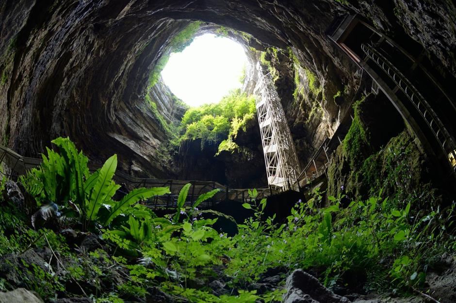
Polje / Blind Valley

Lapies/ Karren
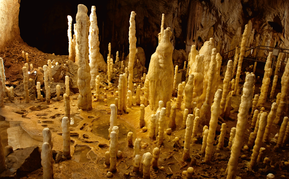
Pillars

Stalactite

Stalagmites
Introduction
The sandbar is the ridge of sand or coarse sediment that is built over a period of time by the waves
Formation
It is formed by the process of longshore drift, which is when sediment is moved along a shoreline due to the action of waves and currents. ➜ This creates a ridge or bar of sediment overtime
Introduction
Barrier bar which gets keyed up to one end of bay creating a hook is called spit. This Hook is generally toward the quieter waters close to shore.
Formation
These are formed just in the same way a Sand Bar forms. A hooked end can form if the wind direction changes.
Introduction
When a long, narrow ridge of sand Island, runs parallel to the shore often separating a shallow lagoon or bay from the open ocean , it is called a “barrier Island”
Formation
Barrier islands can grow from spits and Bars that are broken up. These bars and Spits grow up above the water line over time forming these Island Features.
Introduction
When the mainland is attached to an island by a narrow piece of land such as a bar or a Spit it is a Tombolo
Formation
Similar to sand Bars and spits, Longshore drift moves sand out along the coast➜ As sediment accumulates and is deposited between the island and the mainland, a ridge or bar of sediment begins to form. ➜ Over time, the build-up of sediment increases, connecting the island to the mainland
Introduction
A lagoon is a shallow body of water that is separated from a larger body of water by a natural barrier.
Formation
Longshore drift moves sand out along the coast➜ The resultant landforms which remain submerged are called bars/ spits or barrier islands. The enclosed water body so created is called a lagoon.
Introduction
A salt marsh is a coastal landform that is a low-lying, vegetated area between the land and the sea that is regularly flooded by tides.
Formation
Salt marshes usually form in sheltered coastal systems, such as lagoons , bays and estuaries where fine sediments can be deposited. Salt marshes may be formed behind a spit as well.
Introduction
A bay can be considered both an erosional and depositional landform because while the initial formation of a bay often involves erosion by waves and currents carving out a recessed area in the coastline, the sheltered area within the bay can then become a site for sediment deposition, creating beaches and other depositional features.
3. Glacial Landforms
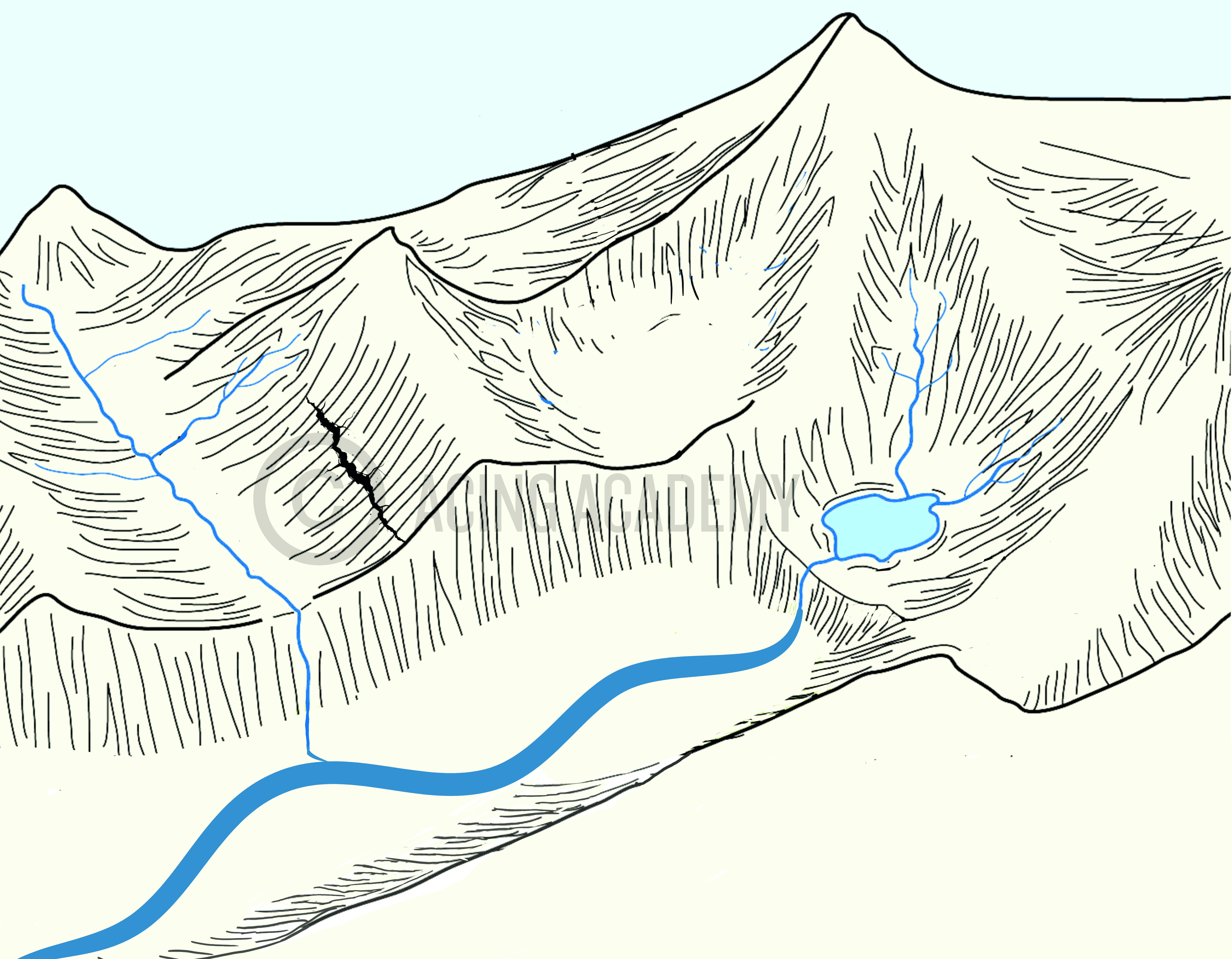
Arete
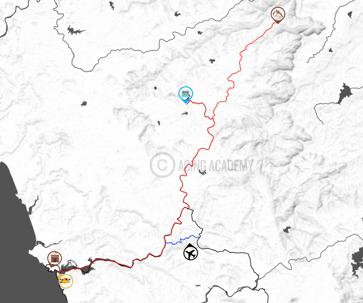
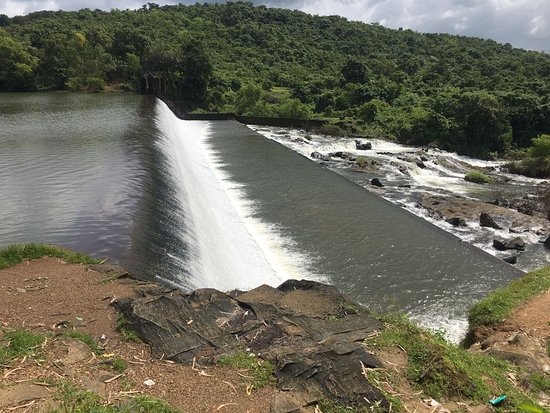
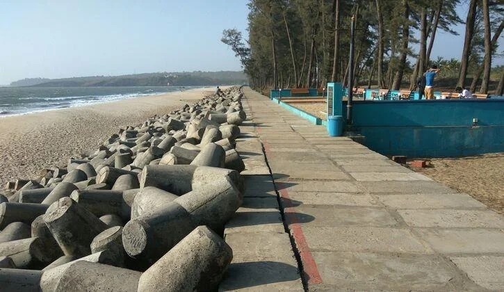
Madkhol Dam
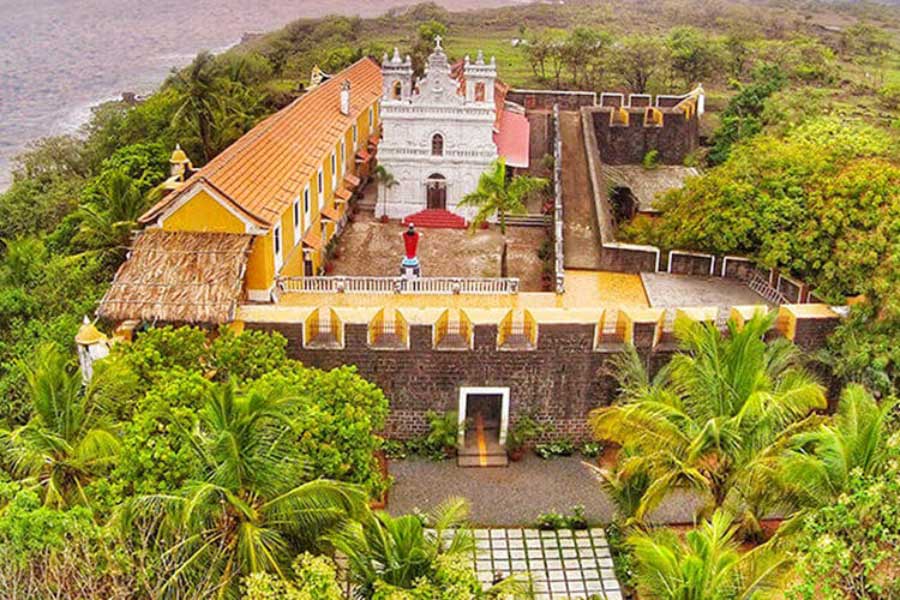
Manohar Mansantosh Gad

Tiracol Fort
Manohar Int. Airport

Querim Beach
Pyramidal peak
Hanging Valley
U Shaped Valley
Introduction
The sandbar is the ridge of sand or coarse sediment that is built over a period of time by the waves
Formation
It is formed by the process of longshore drift, which is when sediment is moved along a shoreline due to the action of waves and currents. ➜ This creates a ridge or bar of sediment overtime
Introduction
Barrier bar which gets keyed up to one end of bay creating a hook is called spit. This Hook is generally toward the quieter waters close to shore.
Formation
These are formed just in the same way a Sand Bar forms. A hooked end can form if the wind direction changes.
Introduction
When a long, narrow ridge of sand Island, runs parallel to the shore often separating a shallow lagoon or bay from the open ocean , it is called a “barrier Island”
Formation
Barrier islands can grow from spits and Bars that are broken up. These bars and Spits grow up above the water line over time forming these Island Features.
Introduction
When the mainland is attached to an island by a narrow piece of land such as a bar or a Spit it is a Tombolo
Formation
Similar to sand Bars and spits, Longshore drift moves sand out along the coast➜ As sediment accumulates and is deposited between the island and the mainland, a ridge or bar of sediment begins to form. ➜ Over time, the build-up of sediment increases, connecting the island to the mainland
Introduction
A lagoon is a shallow body of water that is separated from a larger body of water by a natural barrier.
Formation
Longshore drift moves sand out along the coast➜ The resultant landforms which remain submerged are called bars/ spits or barrier islands. The enclosed water body so created is called a lagoon.
Introduction
A salt marsh is a coastal landform that is a low-lying, vegetated area between the land and the sea that is regularly flooded by tides.
Formation
Salt marshes usually form in sheltered coastal systems, such as lagoons , bays and estuaries where fine sediments can be deposited. Salt marshes may be formed behind a spit as well.
Introduction
A bay can be considered both an erosional and depositional landform because while the initial formation of a bay often involves erosion by waves and currents carving out a recessed area in the coastline, the sheltered area within the bay can then become a site for sediment deposition, creating beaches and other depositional features.


 UPSC Exams
  UPSC CSE
 UPSC CAPF
 UPSC CDS
 UPSC NDA
 UPSC EPFO
 UPSC CISF LDCE
 State Upper PCS
  UPPSC PCS
 BPSC CCE
 RPSC RAS
 MPPSC (Madhya Pradesh) CCE
 MPSC (Maharasthra) Rajyaseva
 WBPSC WBCS
 GPSC CCE
 KPSC (Karnataka) KAS
 APSC (Assam) CCE
 View More
 Defence
 AFCAT
AFCAT BSF SI
 Indian Army Agniveer
 Banking
  IBPS PO
 SBI PO
 RBI Grade B
 Cental Bank Of India Apprentice
 IDBI Junior Assistant Manager
 SSC
SSC  Police
  Bihar Police SI
 UP Police SI
 Delhi Police Head Constable
 Rajasthan Police SI
 WB Police SI
 Assam Police SI
 Odisha Police SI
 Railway
 Other State Exams
 Insurance
 Regulatory Body