
")
 UPSC Exams
  UPSC CSE
 UPSC CAPF
 UPSC CDS
 UPSC NDA
 UPSC EPFO
 UPSC CISF LDCE
 State Upper PCS
  UPPSC PCS
 BPSC CCE
 RPSC RAS
 MPPSC (Madhya Pradesh) CCE
 MPSC (Maharasthra) Rajyaseva
 WBPSC WBCS
 GPSC CCE
 KPSC (Karnataka) KAS
 APSC (Assam) CCE
 View More
 Defence
 AFCAT
AFCAT BSF SI
 Indian Army Agniveer
 Banking
  IBPS PO
 SBI PO
 RBI Grade B
 Cental Bank Of India Apprentice
 IDBI Junior Assistant Manager
 SSC
SSC  Police
  Bihar Police SI
 UP Police SI
 Delhi Police Head Constable
 Rajasthan Police SI
 WB Police SI
 Assam Police SI
 Odisha Police SI
 Railway
 Other State Exams
 Insurance
 Regulatory Body
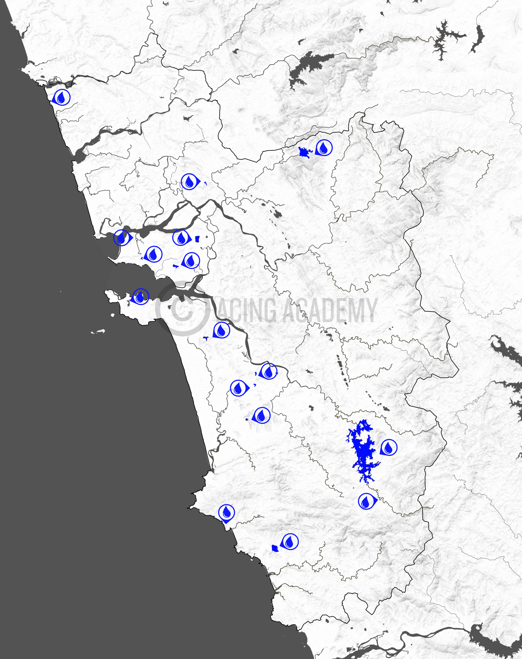
Drainage of Goa
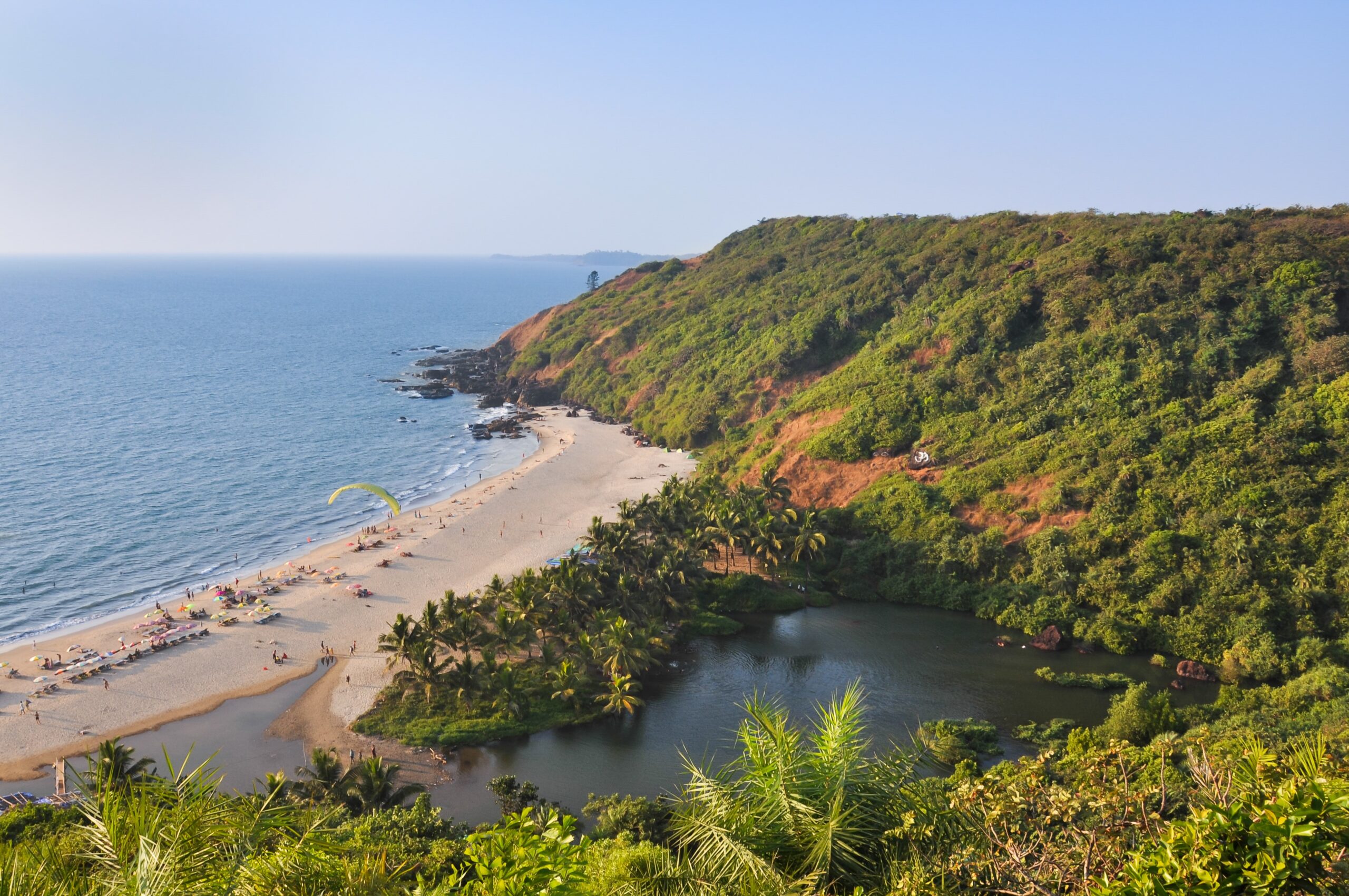
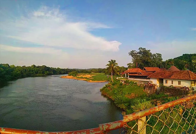
Goa a small but picturesque state is sustained by many rivers. These rivers have supported the land of Goa since the earliest forms of human habitation. The discovery of numerous rare Stone Age carvings stands testimony to this. Most of the prominent rivers of Goa originate in the thick forests, many of them sanctuaries, of Western Ghats and discharge into the Arabian Sea. Landscape of Goa characterized by small area is dominated by these rivers which are an intricate system of wetlands, tidal marshes and cultivated paddy fields interconnected by canals, inland lakes, bays, lagoons and creeks governed by regular tides. Goa is thus more intimately linked with its rivers and also more livelihood dependence on them.
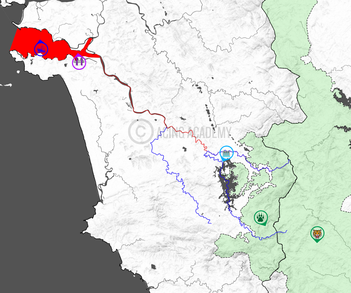
1. Rivers of Goa
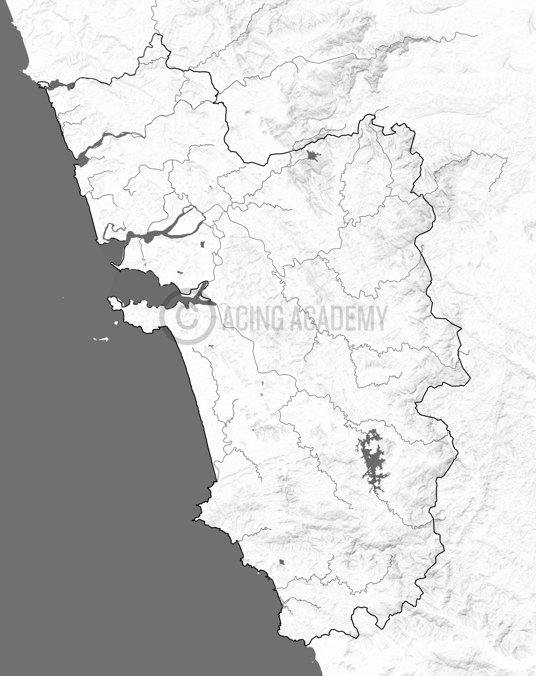
R. Terekhol
Madkhol Dam
Manohar Mansantosh Gad

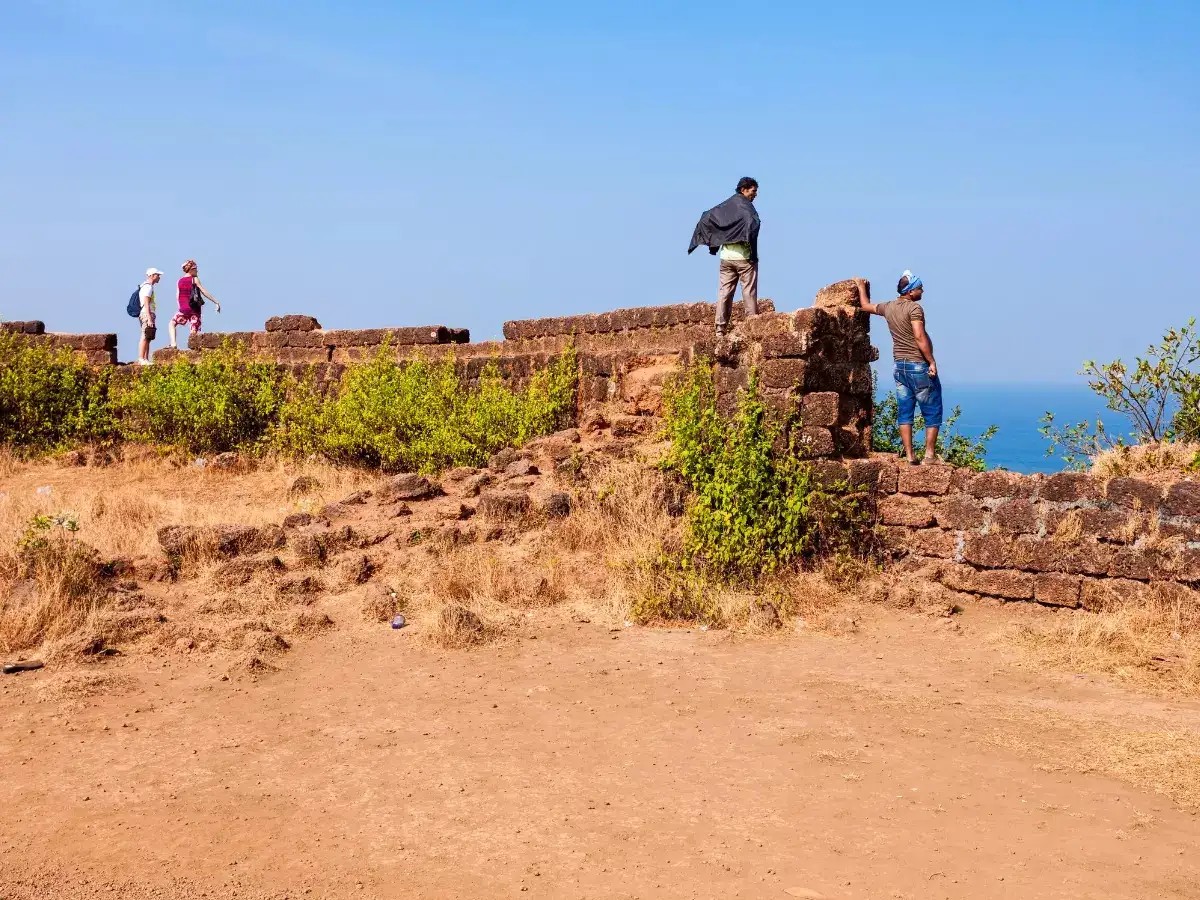
Tiracol Fort
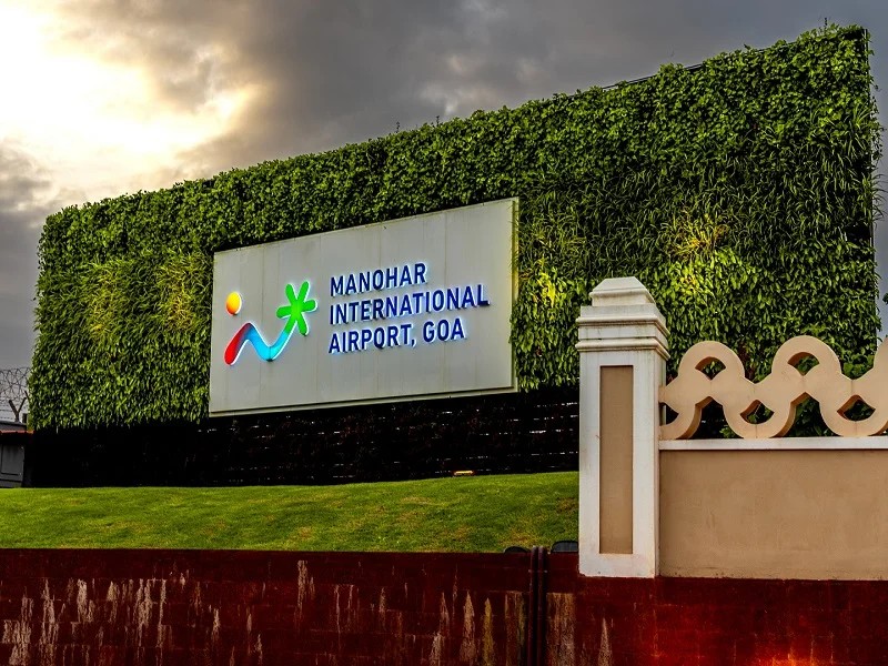
Manohar Int. Airport
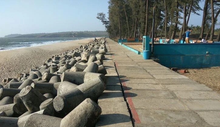
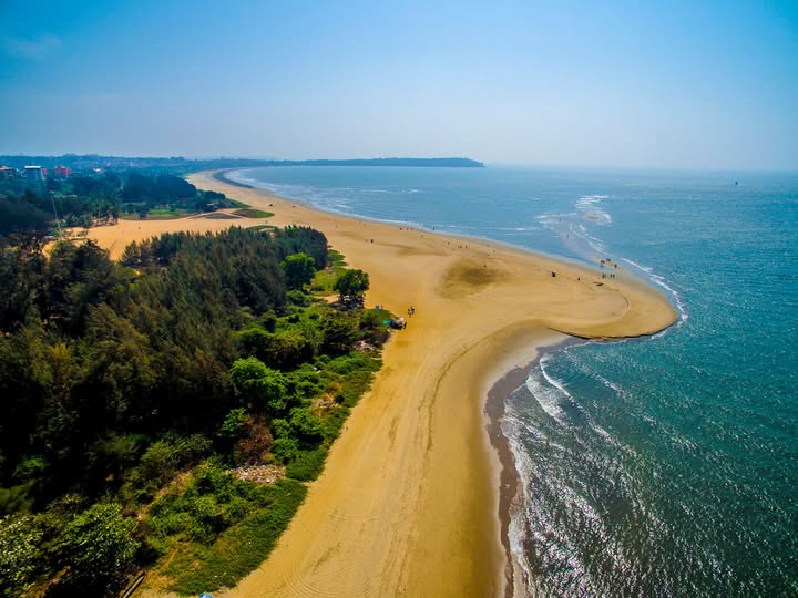
Querim Beach
Terekhol River
R. Chapora
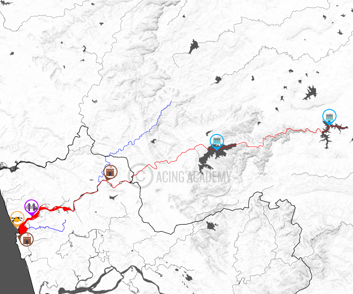
Tilari Project
Alorna Fort
Silom Bridge
Morjim Beach
Chapora Fort
Chapora River
R. Mandovi
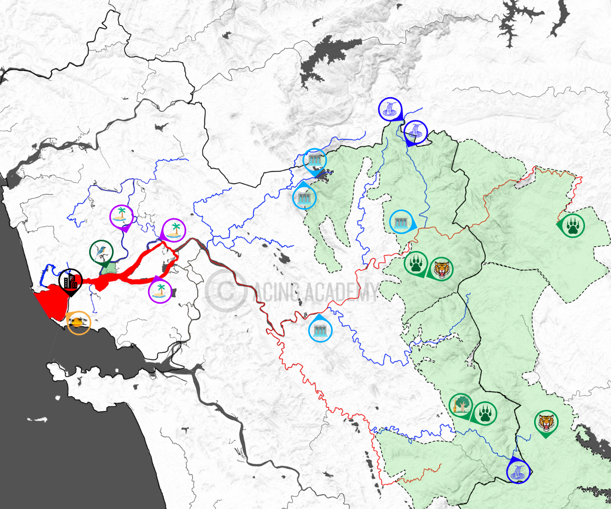
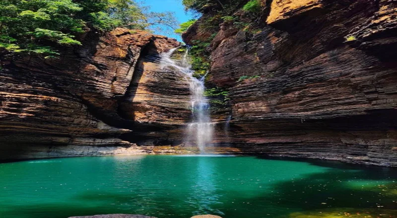
Jalavne Waterfall
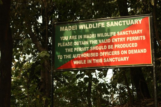
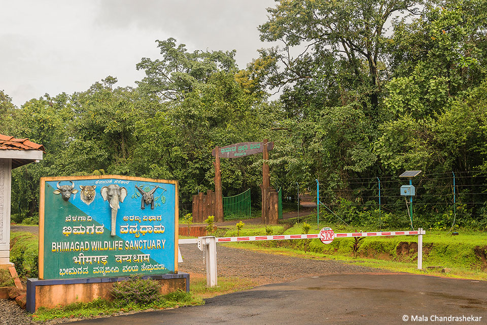
Mhadei WLS and TR
Bhimgad WLS (Belagavi)
Ustem Dam
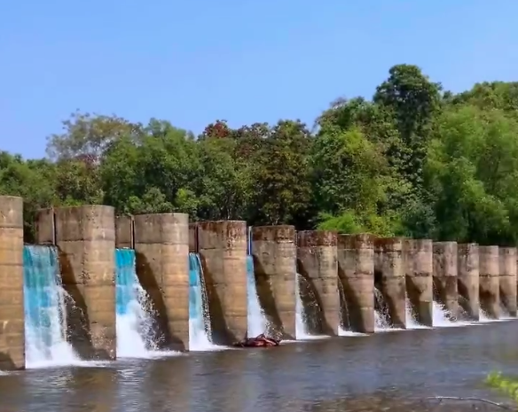
Anjunem Dam
Querim Dam
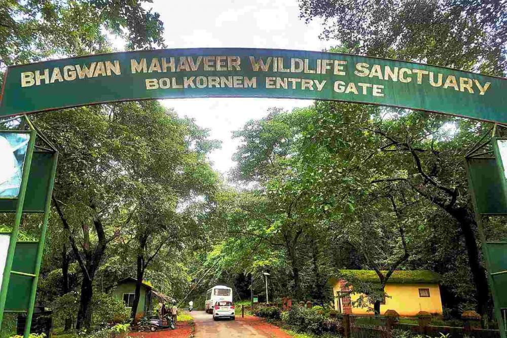
Mollem NP and Bhagwan Mahavir WLS
Miramar Beach
Surla Waterfall
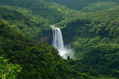
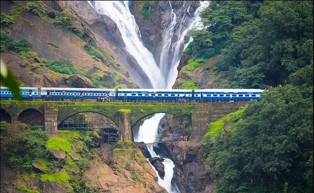
Dudhsagar Waterfall
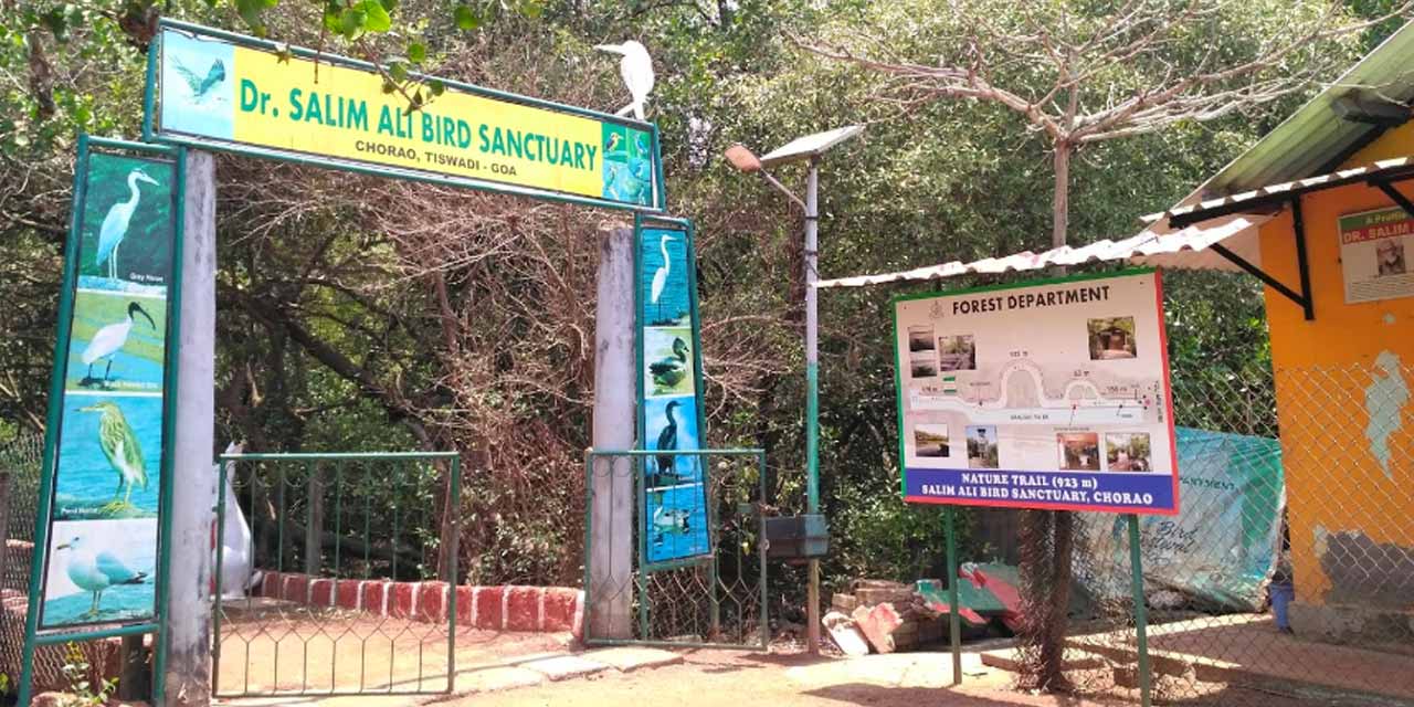
Dr. Salim Ali Bird Sanctuary
Mollem NP and Bhagwan Mahavir WLS
Mandovi River
R. Zuari
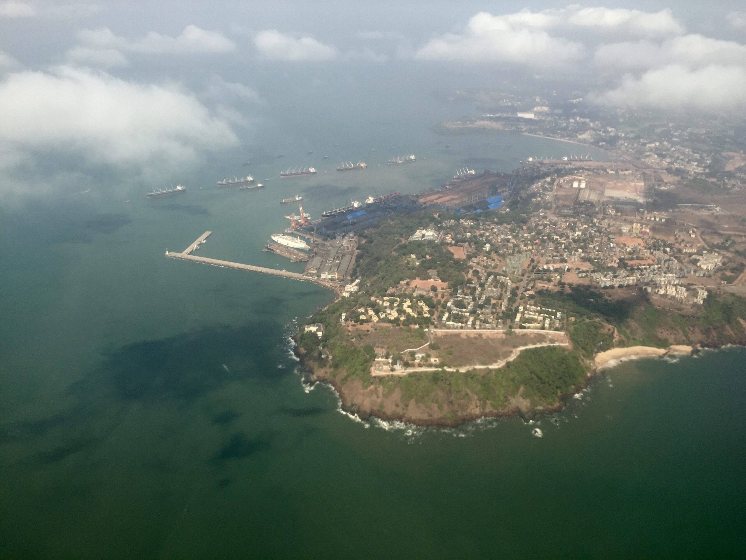
Marmagao (South Goa)
Marmagao Port and Bay
Salaulim Dam
Netravali WLS

New Zuari River Bridge
Zuari River
Coastal Plains
Western Ghats
Mid Highlands
Introduction
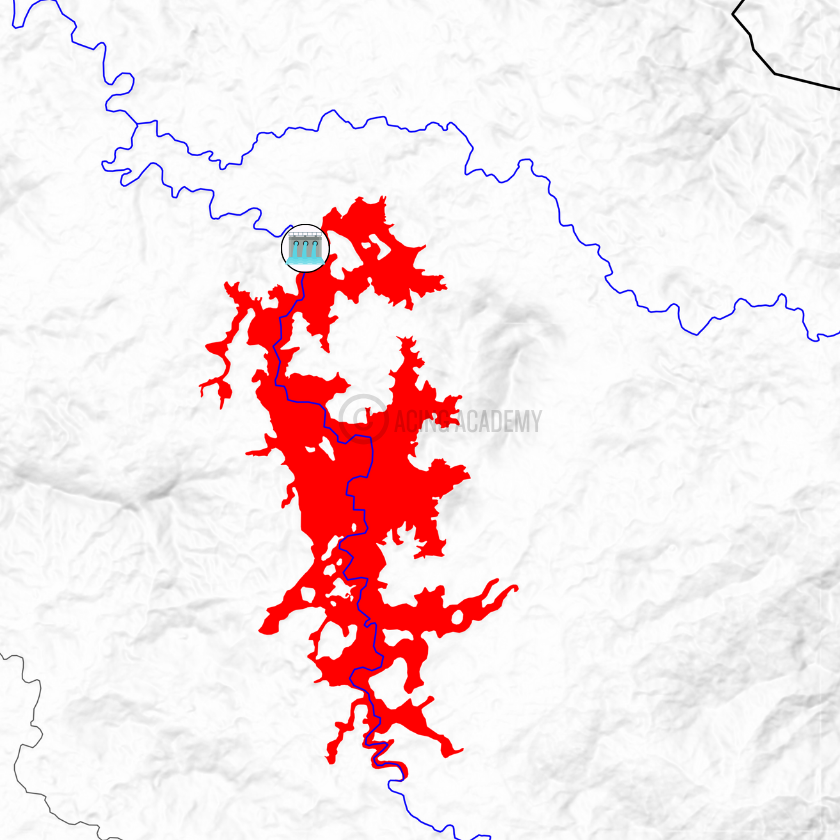
The Mandovi River, also known as the Mahadayi River, is a river that flows through the states of Karnataka and Goa. It is one of the two major rivers in Goa and is considered the state’s lifeline. It travels 35 km in Karnataka; 82 km in Goa making it the 2nd Longest in the State
Origin and Flow
Basin and Tributaries
The Main Tributaries of the River are Mapusa River, Valvanti River, Dudhsagar River, Ragada River, and Kotrachi Nadi already marked on map. There are other small streams at its mouth like St Inez Creek, Rio de Ourém.
Other Features
There are two Important Falls Located on the River 📍In the Mandovi river, near the village of Old Goa, there are three major freshwater islands 📍The Bird Sanctuary is also on this river 📍
There has been a long-standing dispute between Karnataka and Goa over the water from the Mahadayi River. The Mahadayi Water Disputes Tribunal was set up in 2010 to address these disputes
Introduction
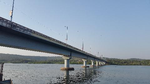
The Zuari River is a tidal river in the state of Goa, India. It is the largest river in Goa and is an important part of the state’s agricultural industry. The Zuari River is also known as the Aghanashini, which means “the destroyer of the sun”
Origin and Flow
The Zuari River originates in the Western Ghats at Hemad-Barshem. It flows through the talukas of Tiswadi, Ponda, Mormugao, Salcete, Sanguem, and Quepem. It flows into the Arabian Sea at Cabo Aguada, forming the Mormugao harbor.
Basin and Tributaries
The Zuari River’s basin extends from Netravali to Panjim, covering nearly 27% of Goa, The Zuari River’s tributaries include the Kushawati River, Guleli River, and Uguem River.
Other Features
The Netravali Wildlife Sanctuary is located in the Zuari River’s basin. The Cumbarjua Canal connects the Zuari and Mandovi rivers, allowing ships to navigate to the interior of Goa.
Introduction
The Chapora River also known as the Colval River is an Important River of Goa. It is a 32 kilometer long river
Origin and Flow
The Chapora River originates in the Ramghat region of Maharashtra. Thereafter It flows West following a zig-zag path through the North Goa talukas of Pernem and Bardez. It meets the Arabian Sea near the historic Chapora fort.
Basin and Tributaries
The tributaries of Chapora include Anjuna River and Calna River.
Other Features
In the 18th century, the river marked the boundary between Portuguese Goa and India.
Introduction
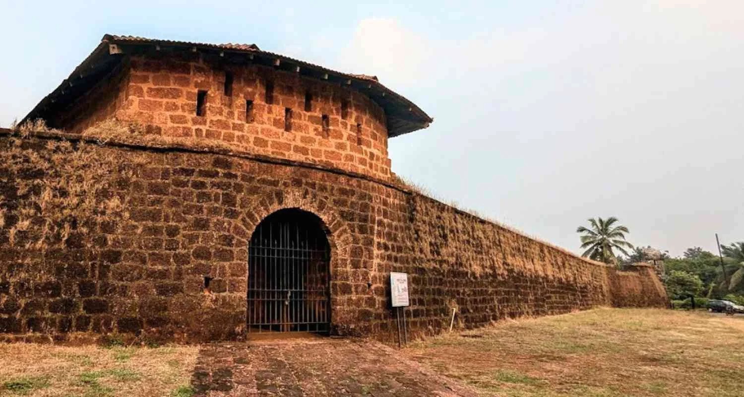
The Terekhol or Tiracol River is a river in western India. In its upper reaches it is known as the Banda River and in the lower reaches as the Tiracol.The length of this river is 27.5 km.
Origin and Flow
The Terekhol rises in the environs of the Manohargad in the Western Ghats and flows in a south-westerly direction It forms the boundary between Sindhudurg district of Maharashtra state and North Goa district of Goa state for some distance. It Enters Goa from the north 📍 near Patradevi. It Empties at 📍
Basin and Tributaries
The main tributaries of the Terekhol River in Goa are Torxe, Khadshi, and Pedne
Other Features
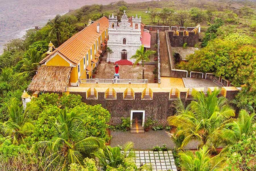
The historic fort of Terekhol is located on its right bank.
Introduction
The Talpona River is a river in the state of Goa, India that is a lifeline for the Canacona region, The river is about 41 kilometers long
Origin and Flow
The river originates in the jungles of Ravan Dongar in the Sahyadri Mountains and flows into the Arabian Sea.
Basin and Tributaries
The river has three tributaries: Nadke, Gaondongrem, and Khalwade .
Other Features
The river has a unique ecosystem with mangroves, dunes, and a headland with a forest . The river has been polluted by household waste, plastic, and other debris
Introduction
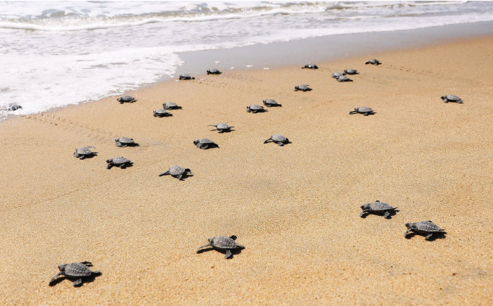
The Galgibaga River is a river in South Goa, India that flows near Galgibaga Beach. The river is known for its mangroves and coastal vegetation.
Origin and Flow
The Galgibaga River originates in the hilly areas of the Uttar Kannada district of Karnataka.
Basin and Tributaries
The Galgibaga River is fed by the Mashe and Loliye rivers.
Other Features
The Galgibaga River is located near Galgibaga Beach, which is also known as Turtle Beach. The Galgibaga River has been affected by cyclones, including Cyclone Tauktae and Cyclone Vayu
Introduction
The Sal River The river is the third longest river in Goa, stretching 35 kilometers. It is located in the Taluka of Salcete, in the Indian state of Goa.
Origin and Flow
It Originates from a small spring in Verna Village, South Goa.
Basin and Tributaries
It has two tributaries, namely Navelim Nallah and Cincolim Nallah..
Other Features
The Sal River flows through urban areas like Verna, Madgaon, Navelim, and Benalulim
Introduction
The Saleri River is a river in Goa, India that flows into the Arabian Sea. It’s one of the 11 rivers that sustain Goa.
Origin and Flow
The Saleri River originates in the forest near the border of Barcem and Gokuldham villages in Quepem
Basin and Tributaries
The Padi and Molore rivers join the Saleri River
Other Features
The Saleri River, along with other rivers in Goa, provides potable water and supports the state’s ecosystems. The Saleri River is threatened by deforestation, agriculture, and other human activities
Introduction
The Mandre river originates from the jungle of Corgao. It flows through Mandre, Corgao, and finally unite with the sea after covering 8.75km distance.This river is projected to be extinct due to increased human activities near the river.
Introduction
The Harmal river originates in the Corgao. It flows for a distance of about 11 km in the west direction. Finally, it enters the Arabian Sea. The infrastructure projects undertaken for tourism purposes have adversely affected the river.
Introduction
The Baga river is the smallest river in Goa. It rises from the jungle of Assagao. A small stream of water from the Saligao hill meets the Baga river at Arpora. It is 10 km long. The river joins the Arabian Sea. Garbage disposal and sewerage treatment are the two main reasons for the pollution of the Baga river. Various tourism activities have seriously destroyed the river’s natural drainage.
2. Lakes of Goa
Anjunem Lake

Anjunem Lake
Anjunem Dam
Querim Dam
Anjunem Lake
Mayem Lake
Arambol Sweet Lake
Carambolim Lake
Batim Lake
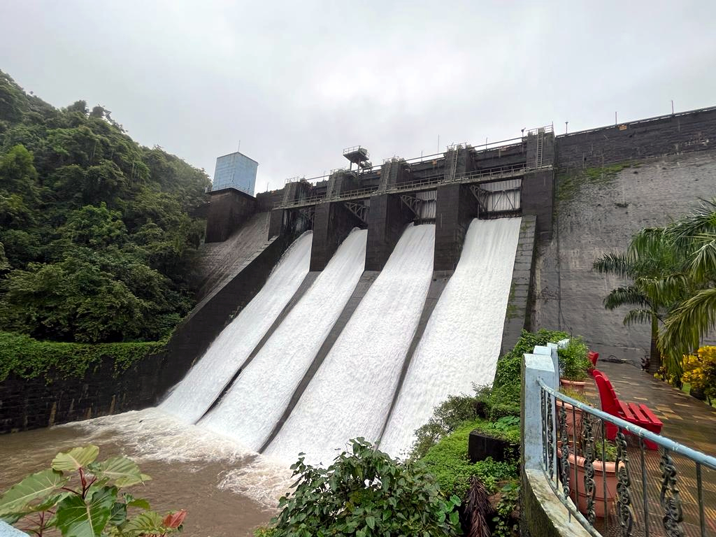
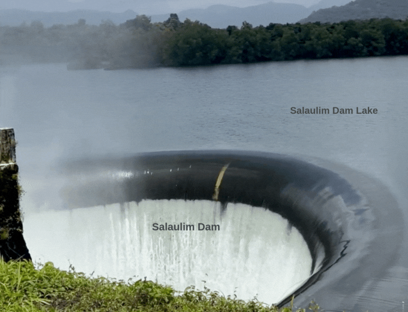
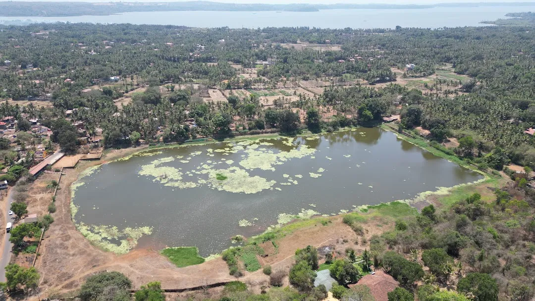
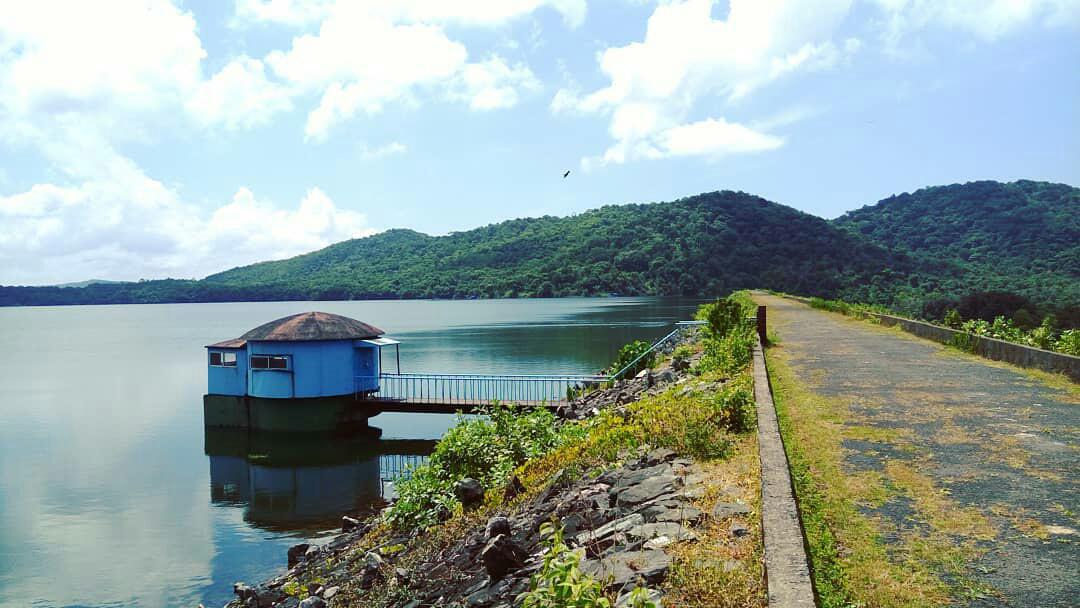
Salaulim Lake
Salaulim Dam
Salaulim Dam
Netravali Bubbling Lake

Sarzora Lake
Vaddem Lake
Bondava Lake
Mala Lake
Curtorim Lake

Raitollem Lake
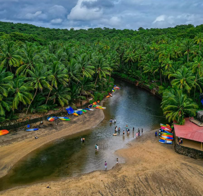
Cola Beach Lagoon
Chapoli Dam Lake
Ambulor Lake
Location
The Arambol Sweet Water Lake is a freshwater lake located in the northernmost corner of Goa, India, near Arambol Beach, in the Pernem taluka of North Goa,
Type of Lake
Arambol Sweet Water Lake is a freshwater lagoon
Other Features
The Sweet Water Lake can be found by the small stretch of shoreline known as Kalacha Beach.
Location
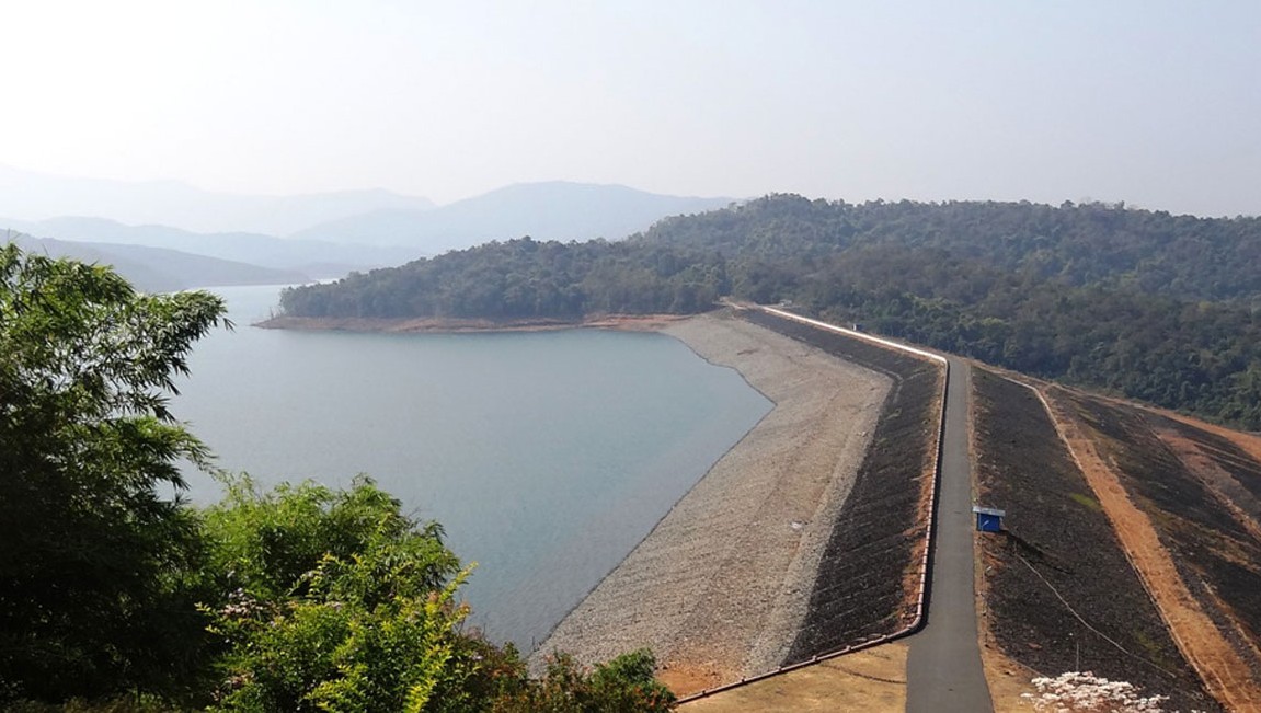
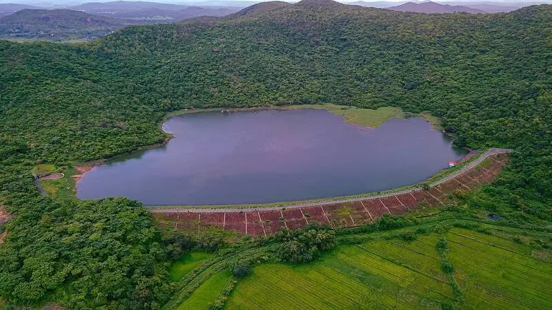
Anjunem Lake, formed by the Anjunem Dam, is a vital water reservoir in the Sanquelim region specifically at Anjunem village.
of North Goa, serving irrigation, water supply, and flood control purposes.
Type of Lake
Its a man-made lake Dam formed by damming a river (Costi nadi) a tributary of the Valvanti River.
Other Features
The Anjunem Dam is located on the Sanquelim-Belgaum highway (748AA) in Chorla ghat
Location
Mayem Lake is located in Bicholim taluka, in north Goa, India. It’s east of Mapusa town
Type of Lake
Mayem Lake is a freshwater lake
Other Features
The Anjunem Dam is located on the Sanquelim-Belgaum highway (748AA) in Chorla ghat
Location
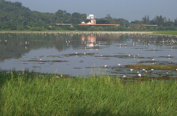
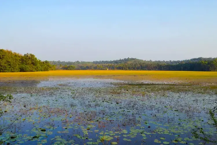
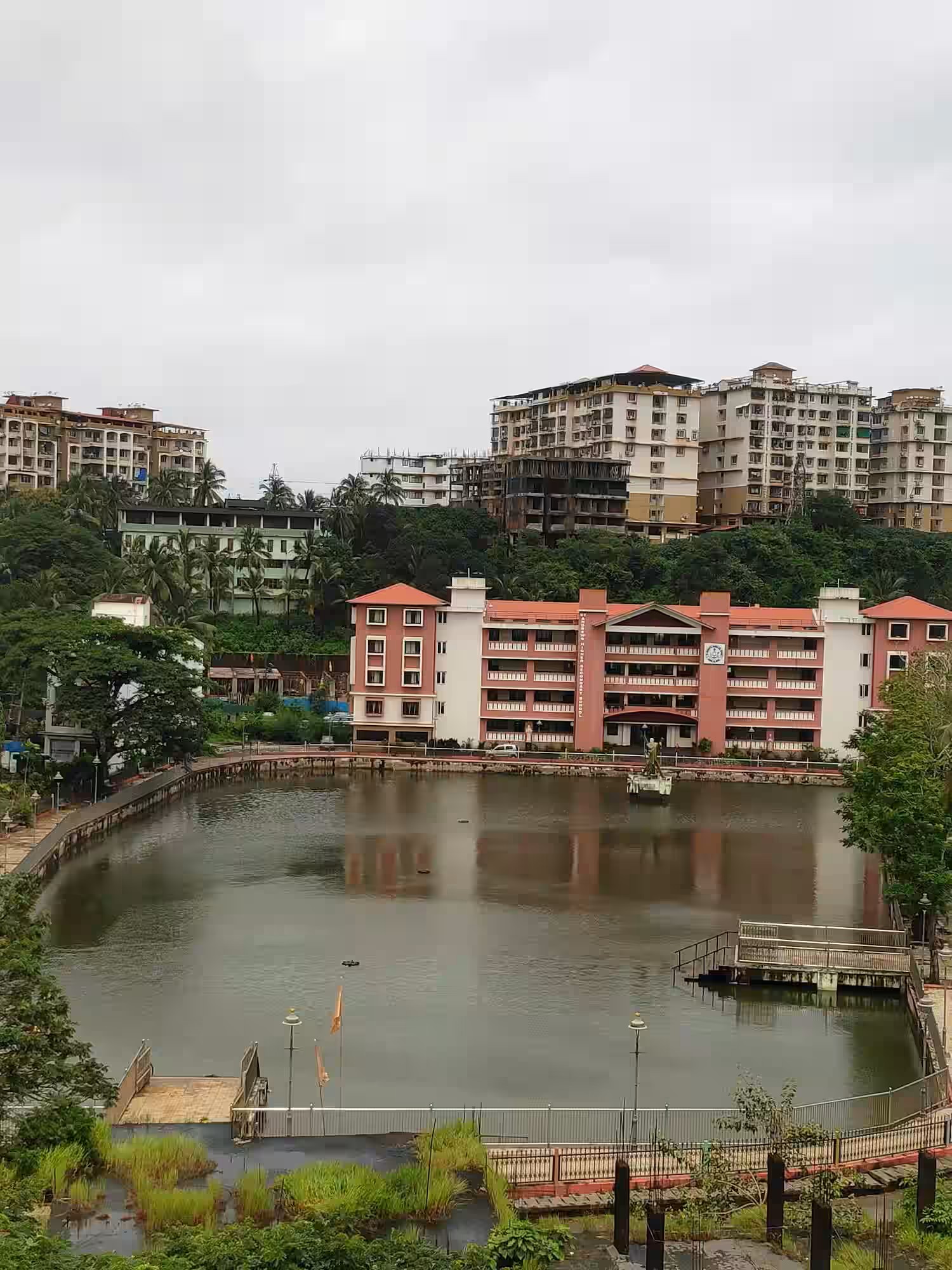
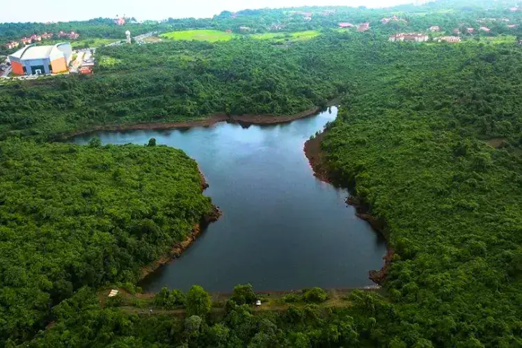
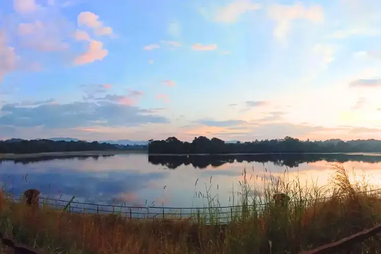
Carambolim lake near the village of Carmali is situated in Taluka of 📍in the estuarine zone of the two of the most Important rivers of Goa 📍It is also the Largest Lake of Goa with a spread over an area of 70 ha. It is situated adjacent to the National Highway 📍that connects Belgaum in Karnataka and ends at Panaji
Type of Lake
Carambolim Lake is a man-made, freshwater lake originally created for irrigating paddy fields
Other Features
The lake is a bird-watching paradise and is home to many species of birds, including migratory birds in the Carambolim Lake Migratory Bird Sanctuary 📍
Location
Curtorim Lake is a freshwater ecosystem in the village of Curtorim, South Goa . Its also known as Ambulor Lake. its used to irrigate the ‘vaingon’ crop and cultivation of ‘xelli’ crop.
Type of Lake
Its a man-made water body intended for irrigation and fishing
Location
Carambolim lake near the village of Carmali is situated in Taluka of 📍in the estuarine zone of the two of the most Important rivers of Goa 📍It is also the Largest Lake of Goa with a spread over an area of 70 ha. It is situated adjacent to the National Highway 📍that connects Belgaum in Karnataka and ends at Panaji
Type of Lake
Mala Lake is a freshwater lake
Other Features
It serves as a water reservoir and a flood bay, with a link to the Ourem creek for water discharge.
Location
Carambolim lake near the village of Carmali is situated in Taluka of 📍in the estuarine zone of the two of the most Important rivers of Goa 📍It is also the Largest Lake of Goa with a spread over an area of 70 ha. It is situated adjacent to the National Highway 📍that connects Belgaum in Karnataka and ends at Panaji
Type of Lake
Carambolim Lake is a man-made, freshwater lake originally created for irrigating paddy fields
Other Features
The lake is a bird-watching paradise and is home to many species of birds, including migratory birds in the Carambolim Lake Migratory Bird Sanctuary 📍